Japanese farmers use drones to see their fields faster, spray and plant with more precision, and cover ground that is slow or tiring to walk. That is the short answer to why Japanese agriculture uses drones, and the reason has less to do with the aircraft than with the problems sitting underneath it: an aging workforce, small fragmented paddies, hilly ground, and a policy push to cut chemical use.
What follows is the practical version, not the brochure version. Drones are one tool inside a larger smart agriculture shift, they are not a fix for every farm, and the farms that get the most out of them usually have a specific problem they are trying to solve. Updated for October 2026.
Table of Contents
- 1Why Japanese Agriculture Uses Drones
- 2The four things a drone actually does
- 3What adoption actually looks like
- 4How Drones Are Changing Japanese Farming
- 5Why it matters most on ground that fights you
- 6Where the data goes after the flight
- 7The Main Reasons Farmers Adopt Drones
- 81. Faster crop monitoring across a big field
- 92. Earlier detection of pests and disease
- 103. Targeted spraying instead of blanket application
- 114. Labor savings during seasonal peaks
- 125. Direct seeding that avoids transplanting
- 136. Fewer chemical inputs and less drift
- 147. A written record instead of memory
- 15Why Drones Fit Japan’s Farming Conditions
- 16Mountains, terraces, and small plots
- 17Rice is the anchor crop
- 18Agricultural robotics in the same shed
- 19An aging farming population
- 20Policy support under MAFF
- 21Weather that keeps fields moving
- 22What Technologies Work With Agricultural Drones?
- 23Multispectral imaging and vegetation indices
- 24RTK GNSS positioning
- 25Variable rate application and farm machinery
- 26Software and AI-assisted analysis
- 27Onboard sensors and the aircraft itself
- 28Where the data does not help
- 29What Are the Limits and Risks?
- 30Cost and the ownership question
- 31Training and interpretation
- 32Weather, batteries, and downtime
- 33Flight rules and permissions
- 34Uneven adoption across farm types
- 35Overreliance on automated recommendations
- 36The Future of Drone Use in Japanese Agriculture
- 37Already deployed
- 38Being tested and validated now
- 39How Japan compares to China and the US
- 40Frequently Asked Questions
- 41Why do farmers need drones?
- 42Are drones legal for spraying pesticides in Japan?
- 43How high can agricultural drones fly in Japan?
- 44How old is the average farmer in Japan?
- 45Can drones plant rice in Japan?
- 46How much do farmers pay for drone spraying?
- 47Conclusion: Start With the Farm Problem
Why Japanese Agriculture Uses Drones
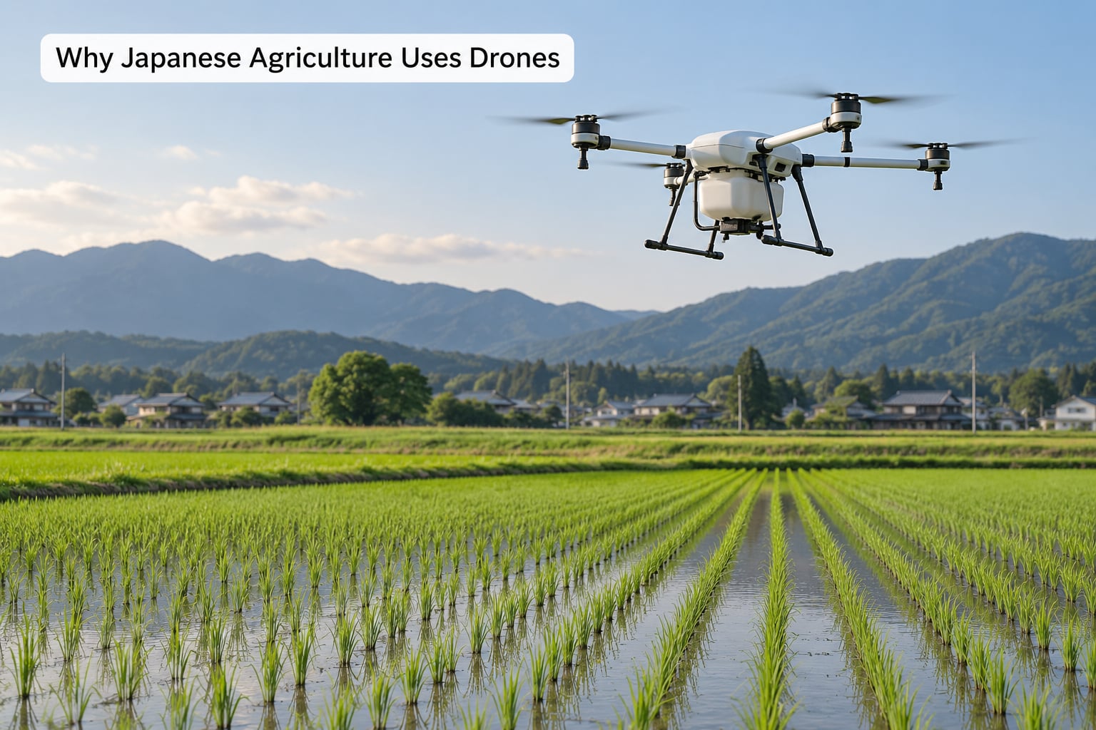
Japanese agriculture uses drones mainly to observe crops quickly, collect precise field data, reduce manual labor, and act on problems before they spread across a whole field. Whether a given farm adopts them depends on field size, crop type, terrain, existing equipment, and what the operation can justify spending.
That second sentence is the part vendor pages tend to skip. A drone is not automatically a good investment for a small hillside plot of vegetables, and it is often an obvious one for a cooperative spraying several hundred hectares of rice.
The four things a drone actually does
Across Japan, agricultural drones cluster into four jobs: spraying crops, planting seed directly, mapping crop health from the air, and surveying or mapping land. The first two are physical work. The last two are information work, and for many growers the information half is what pays for the aircraft.
Farmers also use drones for odd jobs that show up in regional trade shows: photographing fruit trees in orchards, checking slope conditions, and supporting reforestation work. Those are real uses, but they are side businesses rather than the core reason adoption started.
What adoption actually looks like
Most Japanese operations do not own a drone and do not employ a pilot. They buy the service. A contractor flies the aircraft, the flight is logged against the field, and the farmer gets a report or a treatment at the end of it. That contractor model, not individual ownership, is the normal entry point in Japan.
It mirrors what keeps happening in the United States and Europe too, though at different volumes. In Japan the deciding factor is usually that a single farm rarely has enough hectares to amortize a drone, a spare battery set, and the training needed to fly it properly.
How Drones Are Changing Japanese Farming
The workflow is simple enough to describe in four steps, and every step is a place where a drone replaces or speeds up a manual task that used to eat a working day.
- Fly. A pilot or an automated route takes the aircraft over the field on a set pattern, often along a boundary that was mapped beforehand with GPS positioning.
- Sense. A camera collects images. A plain RGB camera gives you pictures; a multispectral or thermal camera gives you measurements of plant stress, water, or soil.
- Map. Software stitches the images into a field map, and indices such as NDVI highlight where plants are growing strongly and where they are not.
- Act. The farmer decides what to do: water that corner, scout that patch on foot, feed that area differently, or send the sprayer over only the affected rows.
The value shows up in that last step. A scouting walk across a large paddy or an orchard block takes time, and it only tells you what you personally noticed. A map covers the whole field in one pass and points you at the spot.
Drone scouting also changes the shape of a season. Instead of one broad look, a grower can check a field weekly and compare maps over time, which turns crop health into a trend rather than a snapshot.
Why it matters most on ground that fights you
On flat, mechanized ground, a tractor can do a lot of the same work cheaply. Drones earn their place on the ground a tractor cannot comfortably work: narrow terrace strips, steep orchard rows, small plots divided by irrigation channels, and paddies that are wet when you need to inspect them.
Terrain is the underrated reason Japanese agriculture uses drones. In a country where roughly two-thirds of the land is mountainous, a large share of cultivated ground sits on slopes where a person, a quad bike, or a conventional boom sprayer moves slowly or not at all.
Where the data goes after the flight
Some growers keep the maps. More farmers use them once and move on, which tells you something important about adoption: many operations want an answer, not a dashboard. The useful version of this technology is a recommendation someone trusts enough to act on that week.
That is also why contractors matter. A service that arrives with a report and a recommendation carries the interpretation burden that a raw map dump would push onto the farmer.
The Main Reasons Farmers Adopt Drones
Seven drivers show up again and again in Japanese farm operations and in the subsidy programs that support them. They are worth separating, because the driver decides which type of drone and which sensor actually makes sense.
1. Faster crop monitoring across a big field
Plant color carries information. A healthy plant reflects a different share of light than a stressed one, and a camera can pick up differences across an entire field in a single flight. Comparing those readings tells you where to walk with a notebook and where to look closely.
2. Earlier detection of pests and disease
Damage often starts as a small patch. Spots that appear in a map, especially in a field of rice, vegetables, or orchard trees, get inspected days before the problem would be obvious from a road. Early detection means a smaller treatment area, which means less chemical and less cost.
3. Targeted spraying instead of blanket application
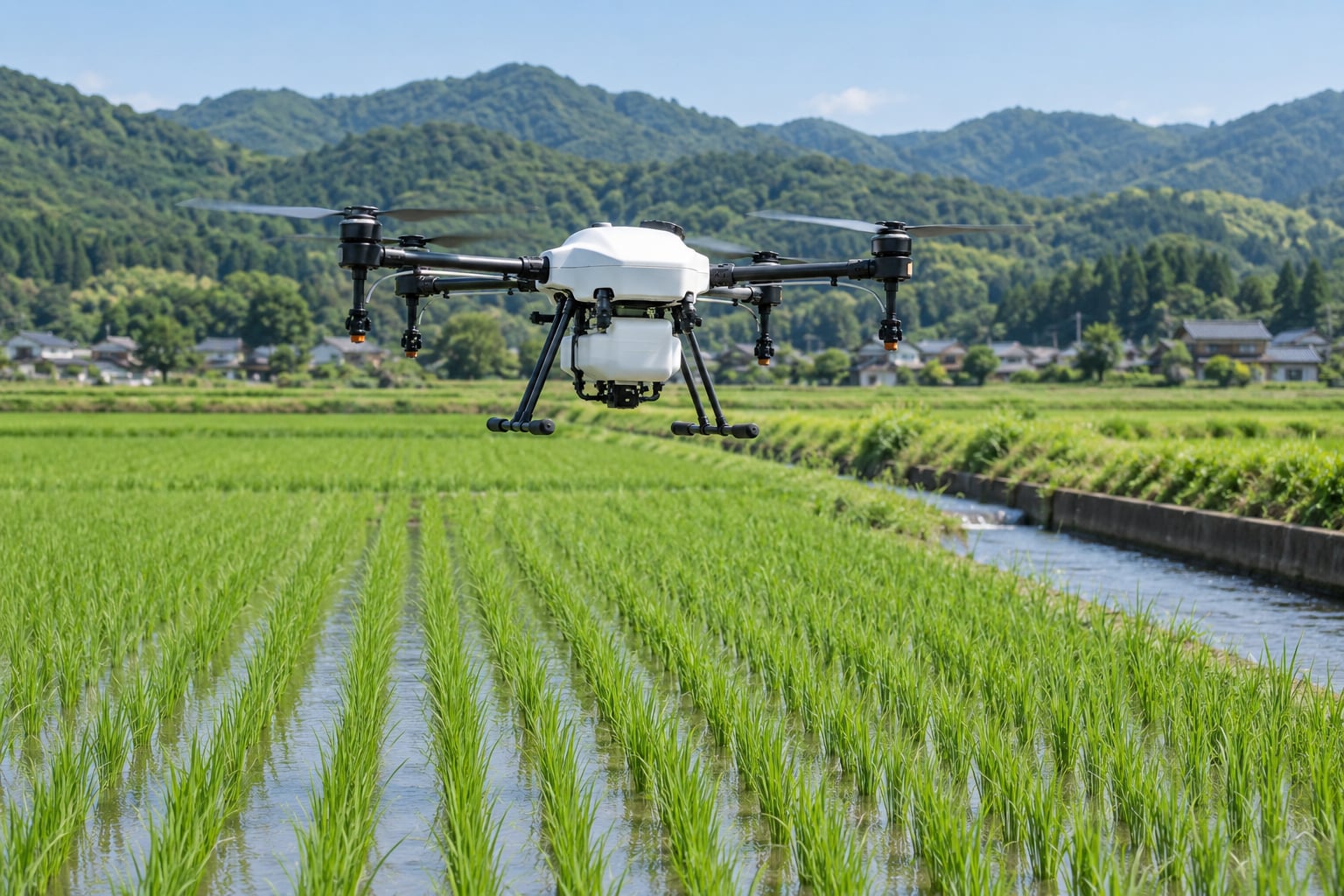
Drone spraying is the most visible use in Japanese paddies, and the one most people picture first. Spray atomization from a rotor-mounted system lets an operator cover a paddy without a self-propelled boom sprayer, and to hold off on a pass where the crop does not need it.
4. Labor savings during seasonal peaks
Rice spraying and planting happen in short, intense windows. A drone compresses hours of application into a flight window, and a contractor model removes the need to hire seasonal help for that specific week.
5. Direct seeding that avoids transplanting
Transplanting rice by hand or machine is slow, wet work done in a narrow window. Direct seeding sows into the paddy without transplanting, and drones can broadcast seed into standing water or prepared soil. It changes the planting method, not just the tool, which is why it takes agronomy advice as well as equipment.
6. Fewer chemical inputs and less drift
Applying only where it is needed cuts total volume per hectare, and low-level application reduces the drift that residents living near farmland complain about. Odor and drift complaints are a real local political issue in Japanese rice-growing areas, and that pressure pushes farmers toward targeted application.
7. A written record instead of memory
Flights produce geotagged, dated records of what was applied and where. For farms dealing with traceability requirements and residue limits, that paperwork has standing value well after the season ends.
| Reason for adoption | Problem it solves | What changes on the ground |
|---|---|---|
| Crop monitoring | Slow manual scouting over large areas | Field-wide health map in one flight instead of a walk |
| Pest and disease detection | Problems spotted late and spread | Scouting targeted at flagged patches days earlier |
| Targeted spraying | Blanket application, drift, odor complaints | Treatment limited to affected rows, lower volume per pass |
| Labor savings | Short seasonal windows, thinner crews | A season’s spraying handled without hired seasonal help |
| Direct seeding | Wet, slow transplanting in a narrow window | Seeding instead of transplanting, fewer passes over the paddy |
| Reduced chemical input | Input costs and neighborhood complaints | Fewer applications and less product per hectare |
| Digital records | Traceability and application paperwork | Geotagged log of every treatment |
| Hard terrain access | Terraces and slopes slow tractors down | Work possible on terrace strips and steep orchard rows |
Why Drones Fit Japan’s Farming Conditions
Japanese adoption is not a story about farmers chasing a trend. It is a story about specific constraints meeting equipment that addresses them, and the constraints are unusually consistent across regions.
Mountains, terraces, and small plots
Japan’s cultivated area is dominated by fragmented parcels rather than wide-open plains, and a large share of it sits on hillsides. A field that a European or American grower would treat as one unit is often several small plots in Japan, separated by paths, channels, or terrace walls.
Aerial work sidesteps that. There is no need to get a machine through a gap, level, or down a slope. You fly over it. For growers in regions like Kyushu, where fruit and vegetable operations sit on undulating ground, that difference decides the job.
Rice is the anchor crop
Rice paddies are the clearest drone use case in the country, and they explain much of the early enthusiasm. Paddy fields are flat, easy to fly over, planted in tight seasonal windows, and located in communities where application drift is closely watched. Spraying and direct seeding both have an obvious fit there.
Rice is also why the technology spread early in Japan compared with North America and much of Europe, where the dominant crops are broadacre row crops with a different application profile. Community forum discussion often makes the same point: Japan has been flying agricultural drones over rice for well over a decade in practical daily use.
Agricultural robotics in the same shed
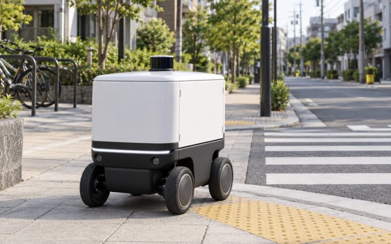
Drone adoption in Japan did not happen alone. Regional trade shows show the same exhibitors presenting autonomous mowers, laser weeding robots, and small smart follower transport vehicles built to run on the same farm roads and terrace edges.
Buyers see these as one equipment category, not five. A farm that has already moved to a sprayer tractor and an auto-steer tractor is closer to buying a drone than one still running everything by hand, and Japanese demonstration projects tend to bundle them together for that reason.
An aging farming population
Japan’s farming population skews heavily toward people in their seventies and eighties, and the share of farmers under forty remains a small minority. Mechanization is the standard response to that arithmetic, and drones sit inside it. They replace a task that used to need a person in the field, not necessarily a person on the ground, and that distinction matters for work like chemical application.
It also explains a side effect people rarely mention: drone flying is attracting younger operators. Forum discussion about Japanese agricultural drone pilots keeps returning to the fact that the new entrants are Gen Z, arriving through robotics and software rather than through a farming background.
Policy support under MAFF
The Ministry of Agriculture, Forestry and Fisheries runs smart agriculture demonstration projects and cost-share schemes that help groups buy and test equipment together. Subsidy availability is consistently the factor farmers name when they explain why they adopted, and a cooperative pooling members’ fields is often what makes the paperwork possible at all.
That is a structural driver, not a technical one. A government-backed demonstration project gives a farmer a reason to try something with an uncertain payoff, and gives prefectural agencies a reason to publish results that other operators can copy.
Weather that keeps fields moving
Typhoon season and heavy summer rainfall compress the usable days in a rice year. When a spray window is short, an application method that can cover a field quickly matters more than one that is marginally more efficient in a long window. Weather volatility turns speed into a yield-protection argument.
What Technologies Work With Agricultural Drones?
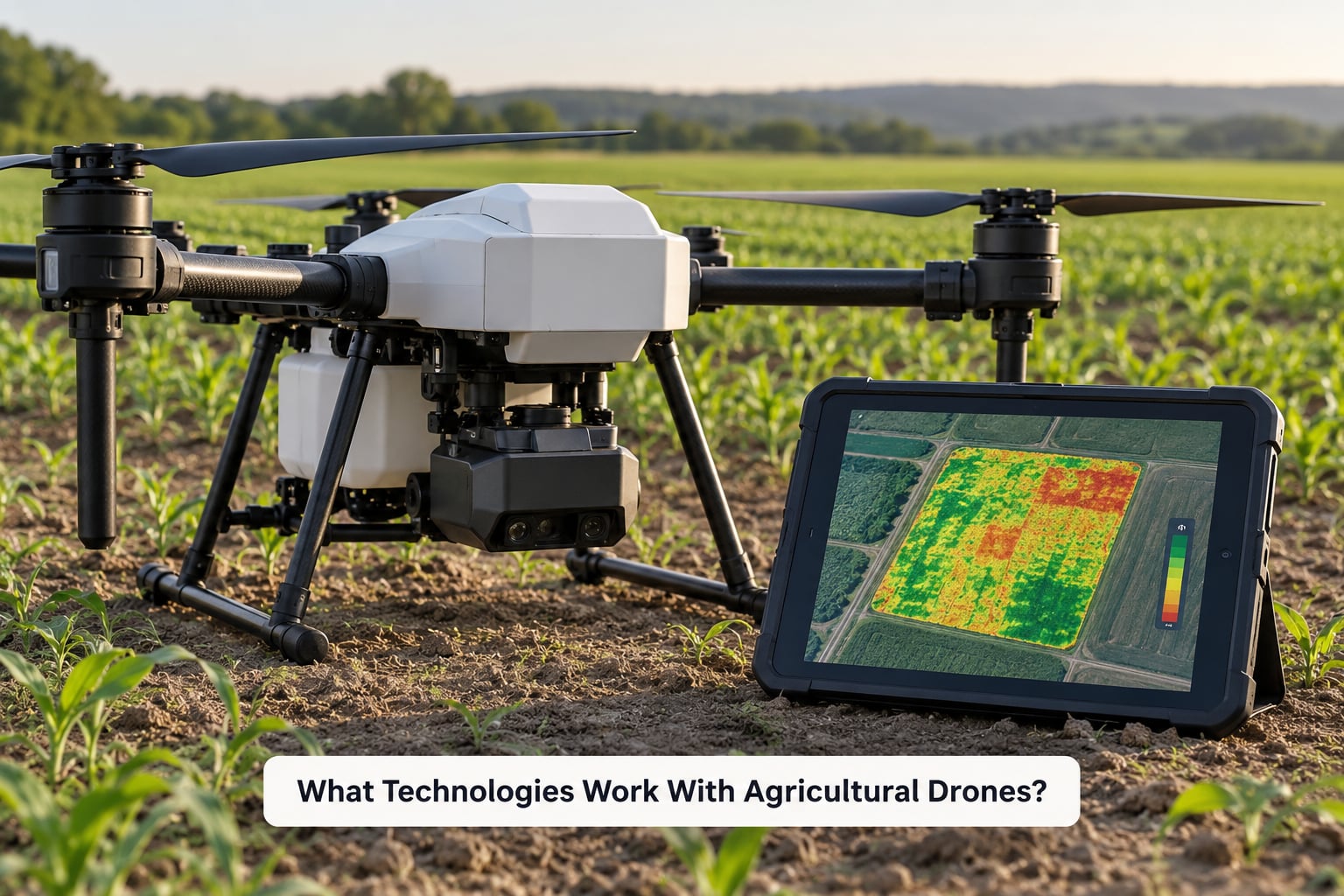
A drone on its own diagnoses nothing. It carries a sensor, produces a file, and hands the interpretation to someone. The value sits in the chain from sensor to decision, which is why the supporting technology matters as much as the aircraft.
Multispectral imaging and vegetation indices
Multispectral cameras record light in specific bands rather than just visible color, which lets software compute vegetation indices such as NDVI. Those indices highlight plant vigor differences that a normal photo can miss, particularly in the early stages of stress.
Forum conversations about Japanese rice farmers often arrive at the same skeptical point: a map is only useful if someone can read it. Without agronomic training, a colorful field image is decoration, and that gap is the single biggest reason data alone has not driven adoption.
RTK GNSS positioning
RTK positioning corrects the satellite signal to centimeter-level accuracy, so a flight follows the same line every time and spray passes overlap properly. In a paddy, consistent passes and correct overlap are what let an operator cut volume without leaving untreated strips.
Variable rate application and farm machinery
Data becomes useful when it can change what a machine does. Variable rate fertilizer, automated steering, and on-the-go section control let a tractor or spreader follow a prescription built from field data, which is where remote sensing turns into an input decision.
Software and AI-assisted analysis
Field reconstruction, cloud processing, and machine-learning classification now sit inside ordinary subscription software rather than requiring a research group. The models handle stitching, index computation, and increasingly pest or disease classification from imagery. They work best on a consistent crop, a consistent sensor, and a consistent season, which is exactly what a Japanese rice operation can offer.
Onboard sensors and the aircraft itself
Spray atomization, payload capacity, flight time under load, and obstacle avoidance decide how much a given aircraft can do in a session. Terrain following and stable hover matter on hillsides, and range matters where a single paddy sits far from a road. Vendors active in the Japanese market include XAG, DJI Agriculture, and platforms sold and supported by names such as Terra Drone, with a few survey and imaging suppliers working alongside them.
Where the data does not help
No sensor reliably confirms a specific disease in the field from a low pass. Imagery narrows the search, and ground inspection confirms it. A grower who treats a red patch on a map as a diagnosis will eventually spray the wrong thing, and the cost of that mistake is part of why adoption is slower than the marketing implies.
What Are the Limits and Risks?
None of this is an argument against drones. It is a description of what still has to be solved, and most of it is solvable with the right operating model.
Cost and the ownership question
Hardware, spare batteries, insurance, training, and a software subscription all stack up. This is the barrier operators name first, and it is the reason the contractor model spread faster than ownership: you pay per service instead of per machine.
Per-area quotes vary widely with field size, terrain, number of passes, and how remote the plot is. Small, awkward parcels are the expensive end of the market, not the cheap end, because the flight time is the same whether the paddy is easy or not.
Training and interpretation
Flying legally and safely takes instruction, and reading the output takes agronomy. Both skills rarely sit in the same person, which is another argument for buying the service rather than building it.
Weather, batteries, and downtime
Rice spraying needs a window that is not too wet and not too windy, and the calendar is short. Battery degradation limits how many passes a day you can fly, and a rain event mid-window pushes everything into a queue.
Regions that depend on drone work also carry typhoon and flood exposure. In those conditions an aircraft is an asset only if the operator has a fallback plan for the season.
Flight rules and permissions
Japan regulates civil drone operation under the Radio Law and the Civil Aeronautics Act, and the practical limits matter for field work. Flights are generally restricted to 150 meters above ground level, and areas around airports require permission. Agricultural spraying adds its own safety obligations around people, property, and drift.
None of this is a barrier so much as a planning step, but it belongs in the adoption conversation because it decides who can reasonably operate. Rural farmland usually makes life easy; operations near infrastructure do not.
Uneven adoption across farm types
Adoption is concentrated where fields are large enough, flat enough, or organized enough to make a flight worthwhile. Very small farms, steep specialty plots, and operations with no successor plan are last in line, and no subsidy has changed that arithmetic entirely.
Overreliance on automated recommendations
A map that flags a problem is a prompt to investigate, not a verdict. Treating an algorithm’s output as ground truth leads to unnecessary applications, wasted input cost, and loss of trust the first time it is visibly wrong.
What works in practice is a triangle: drone data, a walk through the crop, and local knowledge about what happened last season in that field. Drones work best alongside agronomists, experienced farmers, field checks, and local weather and pest information, not instead of them.
The Future of Drone Use in Japanese Agriculture
Some of what comes next is already running, and some is still being tested. Keeping those two groups apart is the useful thing to do here.
Already deployed
- Routine spray services at contractor scale, with flights scheduled by region rather than by farm.
- Multispectral monitoring in rice and orchard blocks, often bundled into a seasonal subscription.
- Direct seeding by drone in specific districts, where transplanting labor is the binding constraint.
- Autonomous flight routes on surveyed fields, which is normal rather than experimental in paddy work.
- Drone-plus-machinery packages sold through demonstration projects, pairing aerial work with smart tractors, mowers, and follower vehicles.
Being tested and validated now
- AI classification of pests and disease from imagery, promising earlier detection and still uneven outside a single crop and season.
- Satellite and drone data fusion, using cheap satellite passes for a wide view and drone flights for the detail underneath.
- Autonomous, coordinated fleets running spraying, monitoring, and transport without a pilot on site.
- Shared-service cooperatives pooling equipment and staff across many small member farms, the model most likely to widen access.
How Japan compares to China and the US
Japan is frequently described as an early adopter, and in practical field use it was, particularly in rice. By volume it is not in the same conversation. Widely cited industry estimates put China’s agricultural drone fleet at many multiples of Japan’s, with a dense domestic manufacturing base and a service market built around smallholder contracting.
The American pattern is different again: larger broadacre operations, fewer drone-specific service contractors per capita, and a bigger installed base of precision-ag software that sometimes treats aerial data as a supplement rather than a core input. Japan’s distinctive position is early field practice plus heavy subsidy support, not fleet size.
| Factor | Japan | China | United States |
|---|---|---|---|
| Fleet size | Early adopter, modest fleet | Far larger fleet by industry estimates | Growing, unevenly distributed |
| Dominant use case | Rice spraying, direct seeding, monitoring | Broadacre spraying and seeding services | Row-crop scouting and input mapping |
| Main structure | Contractor and cooperative service | Dense smallholder service network | Owner-operated on larger farms |
| Policy role | MAFF demonstration and cost-share schemes | National drone delivery and ag modernization programs | Mostly private and state research investment |
| Limiting factor | Fragmented plots, terrain, labor | Hardware cost, operator training | Cost per acre, uneven broadband and service coverage |
That comparison matters for a reader trying to learn from Japan. The transferable lesson is the subsidy-plus-cooperative structure and the contractor model. The fleet numbers are not the lesson.
Frequently Asked Questions
Why do farmers need drones?
Farmers use drones because the work they replace is slow, seasonal, and hard to do well across a large field. A flight covers a whole paddy or orchard block in minutes and produces a map that shows where plants are weak. The payoff is speed, targeted treatment, fewer chemical passes, and less time spent walking. Drones do not replace scouting or agronomy; they make both more efficient.
Are drones legal for spraying pesticides in Japan?
Agricultural drones are legal in Japan, and spraying is among the most common farm uses. Operators still work inside the Radio Law and Civil Aeronautics Act, and practical limits apply, including the 150 meter flight ceiling, permission near airports, and safety rules covering people, property, and spray drift. Most operators also carry liability insurance, which agricultural associations often require before a flight.
How high can agricultural drones fly in Japan?
Civil drone flights in Japan are generally limited to 150 meters above ground level or below. That ceiling is rarely the practical constraint on farm work, because spraying and imaging both benefit from flying low, often well under 30 meters. The restrictions that actually shape operations are the ones around airports, populated areas, and permission to fly over land you do not own.
How old is the average farmer in Japan?
Japan’s farming population skews heavily toward people in their seventies and eighties, and the share of farmers under forty stays a small minority. The average working farmer is well past the usual retirement age, which is the core demographic reason Japanese agriculture uses drones. The motivation is not novelty; it is keeping production stable when the number of people available to do field work keeps falling.
Can drones plant rice in Japan?
Yes. Direct seeding by drone is used in specific Japanese districts, where a drone broadcasts seed into a prepared or flooded paddy instead of relying on transplanting. The method changes the planting process as much as the equipment, and it depends on water management, weed control, and local agronomy support. Where transplanting labor is plentiful, growers often keep using it, because the labor it saves is not the only factor in the decision.
How much do farmers pay for drone spraying?
There is no single national figure, because operators quote per area and the cost depends on field size, terrain, number of passes, and distance to the nearest road. Small, awkward parcels usually cost more per hectare than large flat ones, because the flight takes just as long. Farmers who do not fly their own drone pay a contractor for the service rather than buying hardware, spare batteries, training, and a software subscription.
Conclusion: Start With the Farm Problem
Drones matter in Japanese agriculture because they change how fast a farmer can see a field and act on it. On terrain where a tractor is slow or cannot work, they reach the crop at all. Where a spray window is short, they cover it. Where a map shows weak plants in one corner, they turn a whole-field treatment into a targeted one.
But the aircraft is the least interesting part of the decision. Sensor choice, software, flight rules, battery logistics, and the operating model decide whether the work pays off. A farm that buys a drone before it has named its problem usually ends up with a very expensive way to generate maps.
So the practical first step is narrow: pick one crop, one field, or one seasonal task, and measure what it costs you now. If the answer is a labor shortage, a drift problem, or a scouting window you cannot hit, there is a shape of drone service worth testing. If it is not, a contractor’s flight record will tell you more than another spec sheet.