Japanese navigation apps route trains by turning published timetables into a weighted network of stations and services, then searching that network for the quickest way from A to B while charging you extra for every transfer, every metre of platform walking and every change of operator. When live delay data arrives, the search runs again and your route can change while you are standing on the platform. That is the whole mechanism, and once you understand it, the confusing parts stop being confusing. Last checked: October 2026.
One caveat before we start, because it matters more here than in most explainers. Japan’s rail operators and the app companies do not publish their routing constants. Nobody tells you that a transfer costs exactly so many seconds, or how much fare is allowed to influence a recommendation. What follows is standard transit-routing practice plus what you can observe as a user, and I flag which is which as we go.
Table of Contents
- 1How Japanese Navigation Apps Route Trains
- 2What Data Does a Japanese Train Navigation App Use?
- 3Static schedules versus live feeds
- 4What GTFS is and why it matters
- 5How Japanese navigation apps route trains outside the big cities
- 6Quick glossary of terms you will see in these apps
- 7The Step-by-Step Train Routing Calculation
- 8Step 1: the app works out which stations you actually mean
- 9Step 2: it collects every service that leaves after you would arrive
- 10Step 3: it applies the transfer penalty and other route weights
- 11Step 4: it ranks the results and puts them on screen
- 12How Do Japanese Apps Handle Transfers?
- 13How Do Real-Time Updates Change the Route?
- 14Why Can the Fastest Route Not Always Be the Best?
- 15Which Japanese Navigation Apps Are Useful for Visitors?
- 16What each app does best
- 17Why two apps disagree about the same trip
- 18Frequently Asked Questions
- 19Which app is best for train routes in Japan?
- 20Why do Google Maps and NAVITIME suggest different routes in Japan?
- 21Do Japanese train navigation apps work offline?
- 22How do I know if an app’s suggested route is realistic?
- 23Can a train app find the last train home in Japan?
- 24Does a Japan Rail Pass change the route an app suggests?
- 25Conclusion
How Japanese Navigation Apps Route Trains
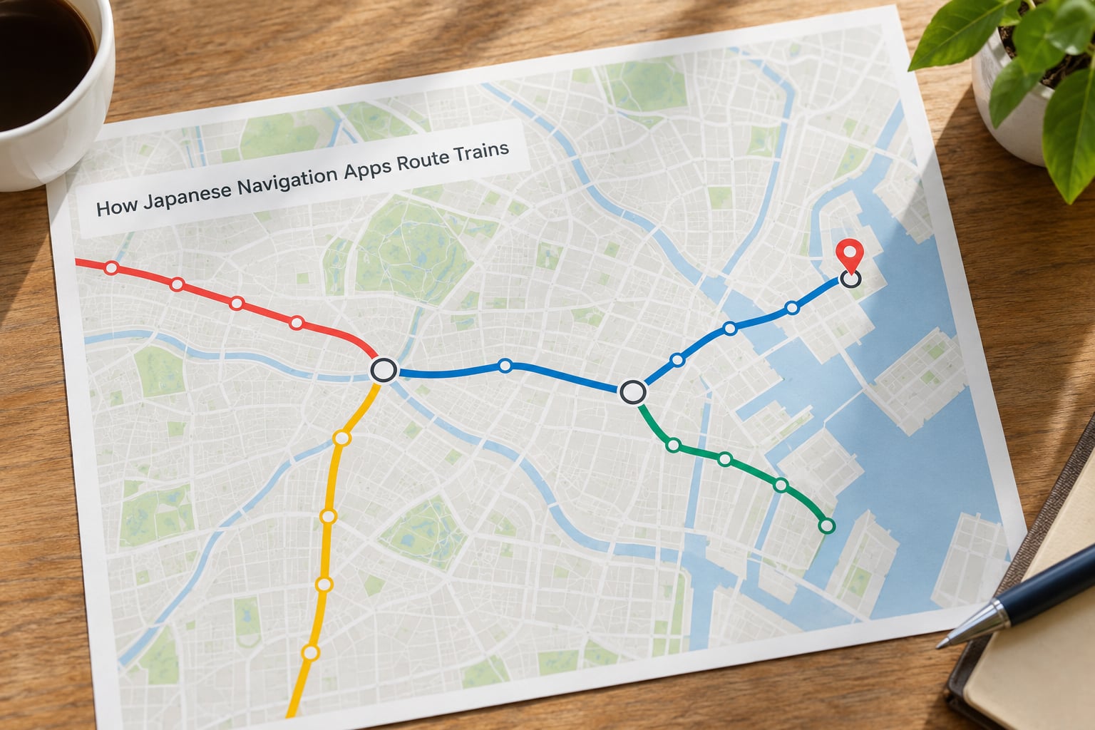
Here is the direct answer. The app loads a timetable, breaks it into individual departures, converts those departures into edges between stations, and then runs a weighted search for the cheapest or fastest path between your origin and destination. “Cheapest” and “fastest” are not the same path, so most apps show several, sorted by the weighting you picked.
Four inputs decide what comes out:
- Scheduled travel time between stations, taken from the operator’s timetable rather than from straight-line distance.
- Transfer cost: how long the app thinks it takes to get from one platform to the next, plus a fixed penalty for the inconvenience itself.
- Walking time inside a station and to the origin or destination entrance, which is often the difference between two otherwise identical routes.
- Fare and IC card rules, which can promote a route with one extra stop if it means staying inside one operator’s network.
Live information is a fifth input that arrives later and overrules the schedule. A delay certificate on the Yamanote Line, a cancelled local service, a platform change at Shinjuku — each one shifts or deletes part of the network and triggers another search.
That search is not one calculation. It is a pipeline, and each stage can produce a different answer depending on the data that stage received. This matters because two apps running the same pipeline on different data will disagree, and neither of them is necessarily wrong.
What Data Does a Japanese Train Navigation App Use?
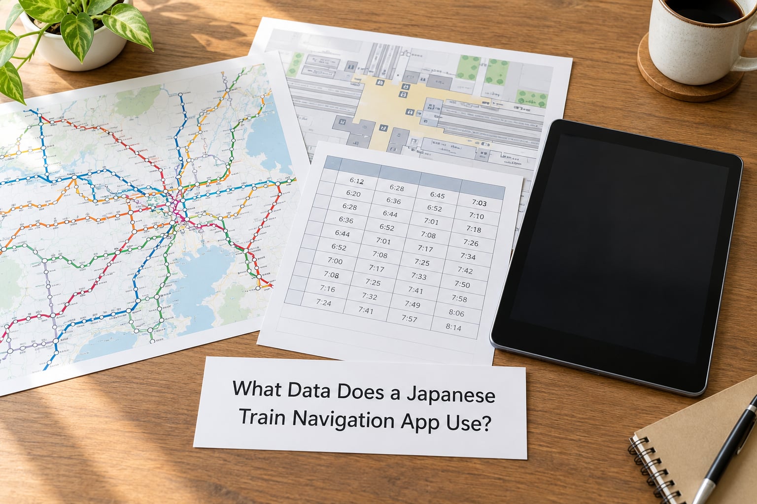
More than people expect. A useful Japanese train app needs station layouts, railway timetables, train classifications, fares, transfer distances, operating calendars and service updates, all indexed well enough to be queried in under a second on a phone.
Here is the practical breakdown of what each layer contributes.
Static schedules versus live feeds
A static schedule is the printed timetable as published: every departure of every service on a normal day, plus variations for weekdays, holidays and seasonal periods. Apps in Japan handle the calendar dimension carefully, because “the last train” differs between a Tuesday and a Sunday, and holiday timetables diverge further.
A live feed is the current state: what is running now, what is running late, what has been cancelled, which platform a train is assigned to. Static data is complete but sometimes wrong by the time you reach the platform. Live data is accurate but only covers the operators that publish it, which in Japan is most of the big urban operators and patchier in regional areas.
What GTFS is and why it matters
GTFS, the General Transit Feed Specification, is a file format defined by the transit industry for publishing timetables in a standard, machine-readable shape. A single feed contains text files that together describe stops, routes, trips and the arrival time of every trip at every stop.
For routing this matters because it removes translation work. When data arrives in a common format, the app does not need a bespoke parser per operator, so adding a small private railway is a data job rather than a software project. GTFS-RT is the companion format for real-time information, published as a stream of updates rather than a timetable.
Japan’s adoption has been uneven and is not something operators advertise, so treat any claim that a given app runs on “GTFS feeds from every operator” as marketing until you have seen it handle a specific small operator. Regionally, feed coverage and update frequency drop noticeably.
How Japanese navigation apps route trains outside the big cities
This is where the mechanism shows its seams. In a metro, an app has dense station geometry, frequent departures and generally complete live data. In a rural area, departures may be two or three a day, live feeds may not exist, and walking time from one platform to another at a small interchange can dominate the whole calculation.
The consequence is that rural routes are still correct on paper but less trustworthy in practice. An app will happily show you a connection with a four-minute buffer at an unmanned station where the two trains are on opposite ends of a footbridge. Look at the transfer time, not just the arrival time.
Quick glossary of terms you will see in these apps
| Term | What it means |
|---|---|
| GTFS | The standard file format operators use to publish scheduled timetables |
| GTFS-RT | The same idea for real-time updates: delays, cancellations, platform changes |
| Through-service | A train that runs over one operator’s track onto another operator’s, so you stay seated |
| Transfer penalty | An added cost applied to a journey for changing trains or lines at all |
| Transfer gate | A station exit and re-entry point, meaning a change of line can cost time and sometimes money |
| IC card | A rechargeable travel card that you tap in and tap out, with the fare calculated from the stations you actually touched |
| Platform and car notation | Numbers showing which platform to wait on and where in the train your destination car stops |
The Step-by-Step Train Routing Calculation
The whole process in four steps: the app resolves your station names into nodes, collects every service that could carry you there, prices each candidate route using transfer and walking penalties plus fare, then ranks the survivors. Live delay data is layered on afterwards and re-runs the same four steps.
Written out, the ranking stage is just a weighted search over a graph — the same family of algorithms used for road routing, running over scheduled departures instead of streets.
Step 1: the app works out which stations you actually mean
Your typed text is matched against a station index that carries romanised names, kana, kanji, station codes and neighbouring-station context. Large interchange stations often appear as multiple entries, one per company, because Tokyo Metro, Toei and JR East each operate their own station there and each publishes its own timetable.
This is a genuinely hard step and a real source of wrong answers. A station index that collapses “Shinjuku” into one entry will route you through whichever platform record it happens to hold first. It also has to cope with stations of the same name in different cities, which is why the app cross-references your current location or the district you picked.
Step 2: it collects every service that leaves after you would arrive
Now the network is built. Every station becomes a node. Every scheduled departure, in both directions and at every time of day, becomes an edge carrying a departure time, an arrival time and a service identifier. Lines, trains and stations are all expressed as scheduled connections rather than fixed links, which is what lets the app time a connection at 23:47 and another at 08:12 with the same code.
Some services only run at certain times. Rapids, expresses and limited expresses have different service patterns across a day, and the pattern is not uniform, so the app must know not just that a train exists but when it exists.
Step 3: it applies the transfer penalty and other route weights
This is where the ranking is decided. Walking time inside a station comes from the station’s own layout data — concourse level, platform number, whether the change requires going through a separate transfer gate. A fixed penalty is then added on top, not because the walk takes that much longer but because each change carries a chance of going wrong, and an app that never penalises transfers will keep proposing journeys with five of them.
Fare enters here too. Where the app has a fare matrix, the search can treat money as a cost alongside minutes, which is how a route with one extra stop on a single operator can beat a nominally faster one that forces two separate tickets.
Step 4: it ranks the results and puts them on screen
The survivors come back as a list, usually ordered by time, then by transfers, then by fare. Most apps let you change that order or add filters — avoid express trains, restrict to certain operators, or exclude passes you are not entitled to use — and each filter re-runs the search rather than hiding results afterwards.
That last detail is the difference between a filter and a filter that actually re-routes. If your Japan Rail Pass does not cover a private railway, an app that excludes those trains during the search will find you a different path; one that filters afterwards will simply show you a route you cannot use for free.
How Do Japanese Apps Handle Transfers?
Transfers are the hard part of routing in Japan, and the reason apps show a transfer time at all rather than leaving you to add the arrival and departure times yourself. The number in the app is an estimate of minutes between the two trains, and it encodes walking distance, vertical distance, and crowd flow assumptions.
Several things inflate that estimate, and all of them come from station layout data:
- Platform changes. The faster service may not use the island platform your train arrived at, so you cross the concourse rather than walk along the platform.
- Transfer gates. Some interchanges require leaving the paid area and re-entering, which adds a queue and, on certain operators, a separate fare. Apps that understand this will either route around the gate or price it into the fare.
- Underground and cross-station connections. Where two companies operate separate underground stations a few hundred metres apart — Otemachi and Hibiya, or Shibuya’s multiple operators — the walk is real and the app has to know about it.
- Last-train cutoffs. A transfer that works at 22:00 can fail at 23:50 if the connecting service has already stopped. The app’s transfer window narrows late at night without telling you why.
Exit numbers and car position are a related layer rather than part of the route maths. An app that knows your destination is near Exit A8 can add a walking leg from the correct exit rather than from the station’s main entrance, and knowing which car stops nearest that exit saves a fight through the aisle.
The genuinely useful habit here: check whether the transfer time the app gives is realistic at rush hour. A four-minute in-station change computed on an average walking speed is a four-minute change at 08:15 on a Monday, and it is a longer one when you are carrying a suitcase.
How Do Real-Time Updates Change the Route?
Live updates arrive as discrete events rather than as a new timetable, and each type has a different effect on the search. A delay pushes a departure later by a stated number of minutes, which can break the connection that was planned after it. A cancellation deletes the departure entirely, which removes an edge from the network.
A platform change is the interesting one, because it does not change the timing at all. It changes which physical part of the station you need to be standing in, so a good app flags it loudly and a mediocre one lets you walk to the announced platform after the train has left.
A service suspension is the largest event of all. When a stretch of line closes for track work — which happens most weekends in Tokyo — the affected edges disappear and the search has to find a detour. Some apps also apply temporary timetables for seasonal periods, such as New Year service or holiday schedules, and swap the underlying schedule rather than patching the live layer.
Because each event triggers a fresh search, a route can be replaced mid-session. This is normal behaviour, not a glitch. When your planned train is delayed, the useful question is whether the app found a new plan that still leaves you with a reasonable connection, and if it did not, whether your ticket rules permit the change it is suggesting.
There is a catch worth knowing. The quality of a recalculation depends entirely on whether your operator publishes machine-readable delay data. Where it does not, the app is reading a delay certificate or a human-entered notice and has less to work with, so the “recalculated” route there is a guess with better odds than nothing.
Why Can the Fastest Route Not Always Be the Best?
Because “fastest” in a timetable world means a mathematical sum of scheduled durations, and a real trip is made of getting lost, waiting, standing in a carriage with no space, and missing one connection. A route with four extra minutes and one fewer transfer is usually the better plan.
The specific reasons the quick option loses:
- Transfers. Each one is a chance to be in the wrong part of a station. Two transfers with generous buffers beat four transfers with four-minute windows.
- Walking. Long station walks add up faster than the app’s estimate suggests when you have luggage, a suitcase or a large backpack.
- Reliability. A route with six independent service legs fails if any one of them runs late. Fewer legs is more robust even when it is nominally slower.
- Last trains. Late-evening searches surface tight connections because the timetable genuinely allows them. The route is correct and the connection is a bad bet.
- Crowding. Rush-hour rolling stock on the Tokyu or Odakyu lines is a different experience from the same train at 10:00, and no timetable captures that.
This is also why experienced travellers cross-reference rather than trust. On the Japan Forum on TripAdvisor and in r/JapanTravel threads, the normal advice is to run the same query in NAVITIME and Google Maps and compare, precisely because a disagreement usually means one app saw a constraint the other did not.
Which Japanese Navigation Apps Are Useful for Visitors?
| App | Strongest at | Platform number | Car position | Rail pass filter | Live delay detail | Useful offline |
|---|---|---|---|---|---|---|
| NAVITIME | Japanese rail depth, Shinkansen planning, train-specific filters | Yes, typically | Yes | Yes, applied during search | Strong in covered areas | Partly, with saved routes |
| Google Maps | Walking, door-to-door times, combining rail with walking and buses | Often, but not always shown | Rarely | Limited | Good on major lines | Yes, downloaded maps and cached routes |
| Jorudan | Detailed timetables, fares and transfer breakdowns | Usually | Varies by operator | Not the main feature | Depends on operator coverage | Weak |
| Citymapper | Clear step-by-step on supported metros, walking time realism | On supported networks | Not typical | No | Good on supported networks | Yes |
| Operator apps, such as JR East’s | Status on one network, disruption notices, station-specific detail | Yes | Varies | Network-specific | Excellent for own operator | Varies |
Features vary by app version and by operator coverage, so treat the table as the shape of each tool rather than a permanent specification.
What each app does best
For most first-time visitors, Google Maps solves the journey itself. It gives line colours, platform numbers, transfer times and exit numbers, and it handles the walking half of the trip that train planners tend to ignore. The recurring complaint on forums is not that it gets the train wrong but that it sends you to an unhelpful exit at a huge station — Shinjuku is routinely described as having well over 200 of them, which is closer to a district than a station.
NAVITIME is the specialist pick for rail specifics: platform and car position, train-type filters, and Shinkansen planning that accounts for seat tiers and transfer stations like Shinagawa or Tokyo. It is also where a rail pass filter genuinely changes the route rather than just the price line.
Jorudan, known in English as the Japan Transit Planner, is the one to open when you want to see the timetable in detail and understand exactly why a route was chosen. Citymapper wins on clarity for supported metropolitan networks and on realistic walking estimates, but its coverage outside the largest cities is much thinner than the other three.
Operator apps are quietly underrated for a specific job: when one network is disrupted and you are standing in it, the operator’s own app is the most authoritative source about what is running and why.
Why two apps disagree about the same trip
Four causes account for almost every disagreement you will see:
- Different timetable data. One app has a fresher feed, or has an operator the other lacks entirely, so one of them is routing around a railway the other cannot see.
- Different transfer penalties. If one app treats a change as cheap and the other treats it as expensive, the second will happily add a stop to avoid the transfer. Neither is miscalculating.
- Different walking estimates. Station geometry data varies, and the gap is widest at big interchanges where one app uses a coarse station centroid and the other uses real platform-level data.
- Different filters. Rail pass filters, avoid-express settings and preferred-operator settings silently remove options from the search. A route that exists in one app may not exist in the other because it was excluded before ranking.
When the two disagree, the app that shows a platform number and a realistic transfer time is usually the more considered answer. And if your route includes a Shinkansen leg, check it against an official operator source before buying anything, because reservation requirements are not something a general route planner models correctly in every case.
Frequently Asked Questions
Which app is best for train routes in Japan?
For most visitors, Google Maps handles the full door-to-door trip with clear line colours, platform numbers and exit guidance, while NAVITIME is the specialist when you need platform and car position details or are planning a Shinkansen leg. Regular travellers tend to cross-reference both rather than pick one, because the two disagree often enough that the difference is worth noticing.
Why do Google Maps and NAVITIME suggest different routes in Japan?
They usually hold different timetable data and weigh transfers differently. One may include a private railway the other cannot see, one may add a bigger penalty for an interchange, and one may use coarser station walking data. A route that appears in only one app is often the result of a filter or a data gap, not a mistake in either app. Check both when a route looks surprising.
Do Japanese train navigation apps work offline?
Partly. Scheduled timetables and station layouts can usually be downloaded, and Google Maps caches directions for areas you have opened before, but live delay and cancellation data needs a connection. Regional areas are weaker than Tokyo because fewer operators publish machine-readable updates there. The safe approach is to open and cache your route while you still have data, especially before an airport transfer.
How do I know if an app’s suggested route is realistic?
Look at three numbers rather than the total time: the transfer time at each change, the walking time inside the big station, and whether the route needs a separate ticket or a transfer gate. A four-minute change computed for average walking speed is optimistic at rush hour with luggage. If a route has four or more changes, expect it to run long.
Can a train app find the last train home in Japan?
Yes, and it handles the late-evening case better than most people expect, because the timetable is indexed by time and day of week rather than by route. The catch is that late-night connections produce narrow transfer windows that are correct on paper and risky in practice. Set your departure time a good margin earlier than the true last train and treat any connection under five minutes as unreliable.
Does a Japan Rail Pass change the route an app suggests?
Only if the app offers a pass filter and you switch it on, because that filter changes what the search is allowed to use. NAVITIME’s rail pass option removes uncovered operators during the search, so the route itself changes. In apps without it, a pass-valid route never appears, because the planner assumes you are paying per journey and optimises on time and fare.
Conclusion
The routing process is simpler than it looks. Japanese navigation apps route trains by converting published timetables into a weighted network, searching it for the fastest connection, charging you for transfers and station walking, and re-running the search whenever delay, cancellation or platform data comes in. Everything else — car position, exit numbers, crowd advice — sits on top of that core.
Three checks before you board. Enter both station names carefully and confirm the app picked the right interchange. Read the transfer time at each change, not just the arrival time. Then look for a live update or disruption notice, since the route you planned an hour ago may no longer be the one running.